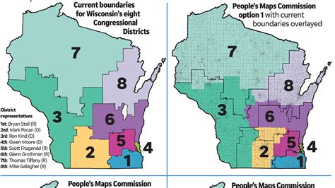
Seeing as State congressional districts are all the talk of the town, lets look at Wisconsin.
In Wisconsin, Congressional districts have been redrawn once every decade, following each federal census. Historically, the process has often been disrupted, resulting in either court-drawn or legislature-drawn maps:
⸻
Redistricting by Decade
• 1964 – The Wisconsin Supreme Court drew the congressional map after the legislature failed to act.
• 1981–1991 – The legislature successfully enacted new congressional maps after the 1980 census.
• 1991–2001 – The legislature again passed a congressional map following the 1990 census.
• 2001 (for 2000 census) – The legislature enacted the plan for the first time Wisconsin held eight seats.
• 2011 (for 2010 census) – Another legislative map was approved following that census.
• 2022 (for 2020 census) – The Wisconsin Supreme Court selected a congressional map (minimizing changes from the 2011 boundaries) under a “least-change” directive.
⸻
How Many Times—and Who Drew Them?
From 1964 through 2022, there have been six major redistricting cycles:
1. 1964 – Court
2. 1981 (for 1982 elections) – Legislature
3. 1991 – Legislature
4. 2001 – Legislature
5. 2011 – Legislature
6. 2022 – Wisconsin Supreme Court (with least-change rule)
⸻
Summary
• Total redraws: 6 over roughly the past six decades.
• Drawn by:
• Court/Supreme Court: 1964, 2022 (2 redraws)
• Legislature (plus governor): 1981, 1991, 2001, 2011 (4 redraws)
⸻


Leave a comment